This morning, waking up near Brookings, Oregon in Umpqua Lighthouse State Park I was quite excited. Today I’d be heading South along the famous highway 101 into the state of my birth. The drive itself is so scenic it becomes hard to get more than a few miles without taking pictures.
McCullough Bridge, An Oregon State Historic Landmark. Built in 1936. Driving along the 101 on July 1, 2011
First you cross the famous architectural wonders: The bridges of 101. These bridges have been featured on shows on the travel channel and it’s no mystery why. Each one was uniquely designed by a renowned architect to awe and inspire travelers.
After some amazing bridges, and right before I crossed into California, I cam across some of the most breath-taking views of coastal cliffs, caves and arches. The sedimentary rocks of the pacific coast are eroded by waves and wind, both carrying sediments that slowly carve out caves, and later carve them into bridges, and towers. It’s a beautiful sight to watch the waves crash into these rocks.
Well-knowing that my drive would be slowed due to the gorgeous views of the pacific ocean my plans involved my camping at Golden Bluffs State Park….however I was greeted with a “campground full” sign. Unfortunately many of California’s campsites are first-come first-serve, meaning no reservations. Since my Grand Adventure put me in California the weekend of the 4th of July all of the campgrounds were full. It doesn’t mean I didn’t enjoy the view.
Roosevelt Elk at Golden Bluffs State Park, California July 1, 2011
I’ve now been on the road for over 50 days and I can’t imagine how to decide which view is the most inspirational, but this would definitely be right up in the top. The west coast’s geology is ever changing at such a rapid pace. As compared to the landforms of the east (our passive margin) the west coast is constantly being changed.
A lot of us are scared of change. We see it as a hurdle to overcome or a step backwards in our trek. Truth is the changes are inevitable the most formative parts of our lives. They are the reasons we love, hate, hurt, smile, laugh and inspire. The west coast is a perfect example of how change will mold you into a better, more beautiful person. Perfection isn’t holding a true form. The closest to perfection you will ever be is to accept the challenges that crash into you and make changes to be a better person.
An arch in the Pacific on the South Oregon coast. July 1, 2011
Looking at these scenes along the coasts of Oregon and California you can see two different things: destruction and construction. You could say that the waves are crashing into the rocks and destroying them…or you could say they are creating these landforms that we enjoy. Standing here on the coast, watching those waves crash and catching my breath as I realize I am truly experiencing this, I learn something.
Destruction is a method of creation. You can’t have construction without some sort of destruction. When life starts crashing into you it isn’t trying to destroy you, it is trying to build a more resilient you. Don’t fight the waves….brace yourself and revel in the fact you will be a better person for it.
Experience. Is. Life. All of it.
Nicole
Golden Bluff’s Campground. Cali. July 1, 2011Highway 101 does dive inland a bit into a portion of the Redwood National Forest. July 1, 2011
The anticipation of seeing someplace new always, in my mind, overrides the hesitance that accompanies the dangers of traveling alone. Even though I am traveling alone, I never truly feel alone. Everywhere I go I find something familiar, and the new age of technology makes me feel tethered to a thousand different people, and similarly places, all at once. The goal of the day was pretty simple in my agenda: make it to the ocean and find a place to camp on the coast. While I was heading to a place I had never visited it is in no way a strange place. There is something comforting and familiar about everywhere I go, and each place both creates memories, and triggers old ones to emerge back on the surface.
As I made my way to the West I noticed a sign that gained my attention. “Wine Cave, turn left 6 miles” it proclaimed. Who could say no to that? Here I was, in wine country, and there was a place that had both a cave and wine together? This cave geologist has a particular taste for pinot noir and here I was in the middle of the particular grape’s habitat. I turned left and started my short detour from my route to the sea.
Reustle “Prayer Rock” Vineyards June 30, 2011 Barrels of wine in the “wine cave”
Reustle Winery is located in the Oregon countryside, and although it has what they call a wine “cave” it does not actually have a cave on property (to my dissapointment). What it does have is an excellent selection of wine, and when you taste they give you culinary creations designed to compliment each specific wine on the taste list. The entire vineyard is gorgeous. The landscape is done tastefully with roses in bloom and plenty of outdoor places to mingle with friends. I was the only customer there at the time, it being the middle of the week and a bit chilly. There are plenty of areas to explore in the vineyard, each one of them as picturesque as the next. I will say their pino noir was definitely worth the detour.
Reustle “Prayer Rock” Winery Vines June 30, 2011
Umpque Lighthouse State Park was the campground of choice for the night. Sitting right on the far southern coast of Oregon, the campgrounds are convieniently located a short walk from the beach. The beach itself has dunes where you are allowed to drive 4x4s on (Although I recommend having tires specified for this use to do so, mine were not). I spent the evening on the beach, under the light of the Umpqua lighthouse, as the sun made it’s way down into the western extent of the Pacific.
Umpqua Lighthouse Beach June 30, 2011 The surfer dogs playing in the surf.
I wasn’t alone. A surfer’s dog adopted me as a temporary friend, fending off the giant black birds that kept trying to steal my banana bread. I drank some wine and stayed until the sun was so far down in the sky it could no longer keep me warm, then I drove up to the lighthouse to watch the last few minutes of the sunset. I reminisced about today’s mixof intertwining interests: Pinot Noir, the Pacific coast, off-roading on a beach (for the first time), even the cave that wasn’t a cave. All things I enjoyed. I started wondering if I find contentment in my life because I always find what interests me, or because I can manage to find an interest in so many things.
Umpqua Lighthouse June 30, 2011
So many people have said this, but I think it needs to be taken with more weight than it is:
“Life is what you make of it”
That is exactly it. This Grand Adventure didn’t happen because I dreamt of it, it’s because I pushed myself to find the drive and the ambition to accomplish it. The world around us doesn’t fill our lives with interesting things, we have to find an interest in the things that the world already provides. The rest of life falls into place after you accept that you can’t seek out something to make you happy. The world already exists, you simply have to change your point of view on what makes life worth living.
Happiness comes in a trifecta. It consists what already exists, what we put into it, and how we view both of those things. The first is a given that we can’t change anything about other than using the third. The other two are things one must consciously be aware of. You can’t expect the world to change for you, you have to find a way to enjoy the world and then do your part to make that part better for yourself and others.
I think my grandmother put it best on a note she gave me just days before I left on this journey: “Anyone can be a dreamer, but it takes someone special to make a dream a reality”.
Dreaming is the essence of inspiration, but you have to obey the trifecta if you plan on making anything out of it. The world is your canvas, the paints your input, and the brush your interpretation of them both. Everyone has the ability to accomplish their dreams, you just have to interpret the dream into a plan- and make it happen.
-Nicole
My footprints in the sand at Umpqua Lighthouse Beach in Oregon. June 30, 2011
Off-roading at Umpqua Lighthouse Beach (Oregon) on June 30, 2011
Many emblems of the world hold multiple meanings. It is of no surprise that a rainbow holds various meanings of symbolism. A rainbow can be a sign of success after a hard time or a symbol that it is ok to be yourself even if you stand out from a crowd. It can also be a way to describe something that has many different faces and colors. A rainbow expresses itself by claiming that it is not strictly the embodiment of one self, but many. Olympic National Park is also a park of many colors- and yes, it even has rainbows.
The Hoh Rainforest of Olympic National Park. June 26, 2011
It comes as a big surprise to many that the continental United States is actually home to a rain forest. The Hoh rain forest located within the protective confines of Olympic National Park receives an average of twelve FEET of rain. This was the first color of Olympic N.P. that I was able to experience, only a few miles south of my campsite in Bogachiel S.P.
Me, peaking out from a Sitka Spruce in the Hoh Rainforest. Olympic National Park June 26, 2011
The lush rain forest is a lot like you would expect. Temperatures are moderated by the lower elevation and maritime effect of the nearby coast; it rarely drops below freezing or above 80 degrees Fahrenheit. Mosses, ferns and lichens grow all over everything, from the expected soil to the trunks of trees and other woody plants they can cling their sticky roots to. The Sitka Spruce trees are probably the most sought trees to visit, they tower into the sky by more than 20 stories.
The circular rainbow of Olympic N.P.'s Hoh Rainforest June 26, 2011
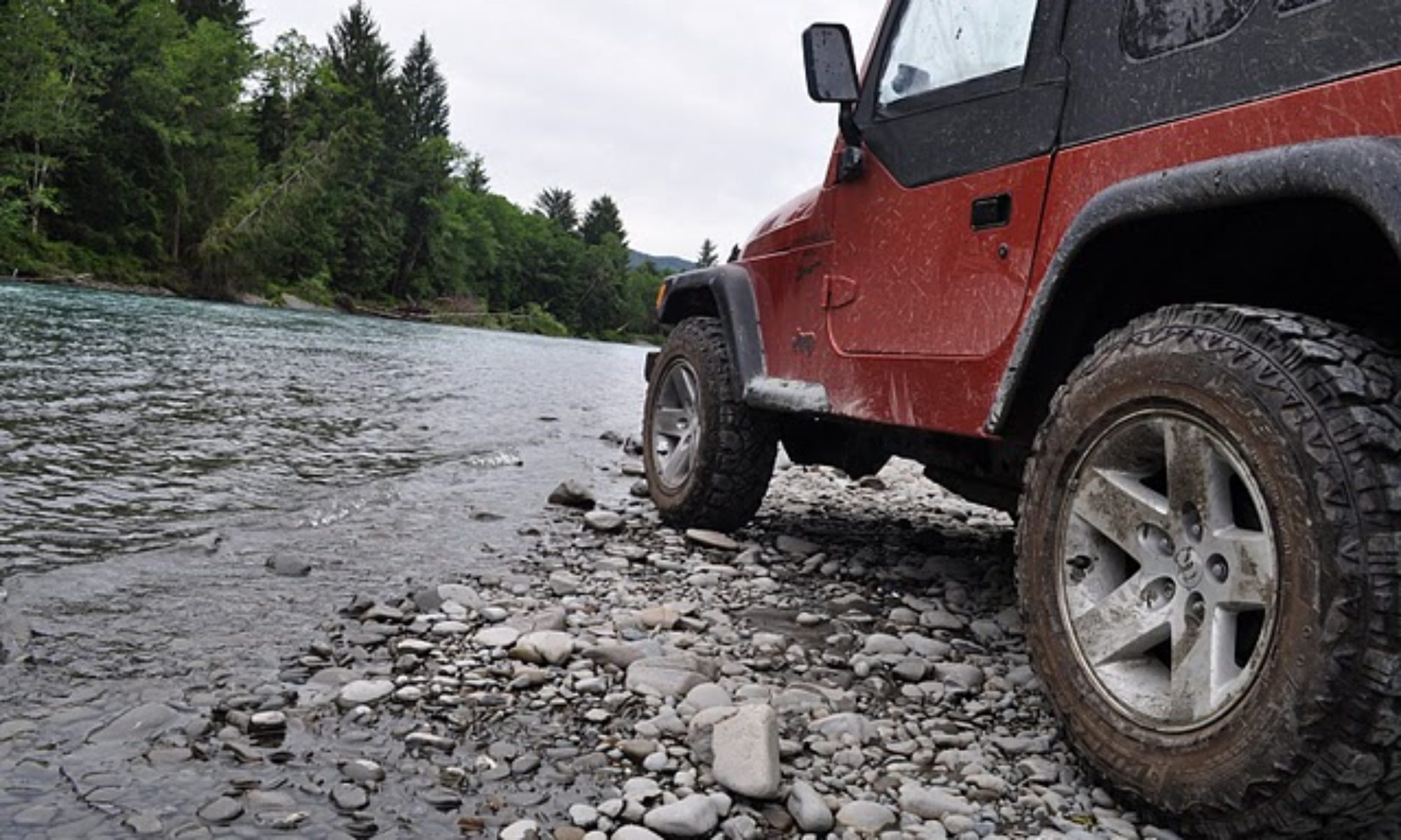
Looking up into the sky- although the dense rain forest does make the sky patches few- often gives you a view of a rainbow halo. The mist from the humid rain forest rises into the sky, forming a circular rainbow that encompasses the sun. Nearby is the Hoh River, and mud roads lead to the cobbled riverbed that you can drive up onto, right up to the river’s edge. It is a beautiful sight (and a lot of fun for those who drive Jeeps!)
Driving in the mud puddles of Hoh Rainforest. June 26, 2011
The colors of Olympic National park don’t stop there. As I headed south along the coast I was able to visit the park’s 73-mile long wilderness coast. Here the forest meets the Pacific in grand views overlooking rocky cliffs, tide pools, towering rocks in the surf, and boneyards of giant Sitka Spruce and other trees that accumulate at river deltas.
A stream outlet and tree boneyard in Olympic National Park's Coastal Wilderness. June 26, 2011
The coast is breathtaking, a stark contrast against the enclosing, green walls of the rainforest, it opens up into a great big sky and the sea that stretches further than the eye can see. Wildflowers line the cliffs as you look down upon the sandy beach below, and in the distance islands interrupt the endless waves of the Pacific.
The Olympic N.P. Wilderness coast. Washington State, June 26, 2011
Looking back inland you can see the mountainous portions of Olympic N.P., some peaks are still topped in snow, an alpine ecosystem less than a half day’s drive from the temperate rain forests and coastal beauties. Not only does the park have rainbows, it is a rainbow itself.
Tomorrow I will be visiting two more colors of the rainbow of a geologic world- ones I have yet to see in person. What colors will I see tomorrow? I guess you will have to come back to find out.
-Nicole
The tree boneyard in Olympic N.P.'s coastal wilderness. June 26, 2011
Today I took it easy and enjoyed some “Free Exploration” time to get a little more time in with the rural areas of Washington before I headed into Seattle. I started heading in the general direction of Seattle on the highways and took a detour anytime I saw something interesting. I decided to explore the forest service roads of the area and I found some great places to camp in the future.
"29" and me, exploring Washington's Forest Service Roads. June 23, 2011
I ran into an abandoned cabin and decided to wander around it. I took my Jeep up and down the roughly-maintained roads and enjoyed the warm weather. It wasn’t anything too exciting but it certainly wasn’t boring. Oddly, it felt like I was back at home cruising the gravel roads and exploring abandoned farm houses. The roads had a larger distribution of elevations and the weather was a bit cooler than Missouri would be this time of year, but the activity was comforting.
The Abandoned Cabin in Washington. June 23, 2011
Tomorrow I would be exploring Pike Place Market in downtown Seattle. I took a deep breath as I returned to the highway and followed the concrete trail into the city. It’s amazing how quickly your surroundings can change from country to city. I was ready for some city-style relaxation and shopping. I would be staying with a relative of mine for a few days and exploring Pike Place Market. I can’t wait!
-Nicole
Abandoned Cabin in Washington State. June 23, 2011
GPS.
Although I am from this era I have fought against the technology generation’s idea of navigation. It wasn’t until this past December that I even owned a GPS. I had borrowed family members GPS from time to time, but I always printed out maps and picked up state and local maps along the way. This summer was a little different. I had a North American atlas- from 2008- but I actually relied on my new GPS pretty heavily. In general the GPS keeps you on interstates and other highways well traveled and dotted with tourist traps and gas stations. Today I must have accidentally changed the settings.
I was making my way from Glacier N.P in Montana to Sandpoint, Idaho. I glanced at the atlas but turned on my GPS and followed it’s directions. I thought I would be staying on highway 2 all the way to highway 95 where I would be on the straight track to Sandpoint. Instead the GPS told me to turn left onto Mc Ginnis Meadows Rd., taking to long way to town.
Soon I found myself driving along a country mountain road that certainly wasn’t wide enough for another vehicle to pass me (if I had run into another soul on the 30 mile stretch of road at all…but I didn’t….I really was in the middle of no where). I don’t know exactly what happened to make the GPS direct me this way. I drove through the water of lakes that had crested their banks onto the dirt and gravel road, I tumbled over washouts above several hundred feet deep ravines filled with rushing rivers. I climbed up to tops of mountains and back down to the bottoms of the river-filled ravines.
Bumping along Vermillion River Rd in Montana/Idaho. June 21, 2011
There was a point where I was afraid I should have turned back. Surely driving alone on these roads where there was no cell phone service wasn’t the smartest move to make. Then again, I was on this trip for adventure…would I ever know what laid at the end of this road if I didn’t follow it? I continued on, and after a certain point it made no sense to turn back. It was time to embrace this near off-roading experience. It was actually quite scenic and the road was fun. I like to blame this event on my Jeep and my GPS plotting against me….
Why do they always have warning signs at the end of my paths of travel and not at the beginning? LOL! Juune 21, 2011
I was happy when I emerged from the wilderness at Noxon Reservoir as the sun began to turn the water gold. The rest of the drive to Sandpoint was along the water, beautiful and serene as it twisted around the mountaineous terraine. I was happy to arrive in town and I found a local restaurant in hopes to enjoy a big meal including a baked potatoe. I was in Idaho, afterall. Turns out the restaurant was out of baked potatoes…
Noxon Reservoir June 21, 2011
I guess that not everything is ideal, but that doesn’t mean it isn’t good. Sometimes life’s curveballs can be just as good as what we thought we had predicted for our lives. We try to make our plans for lives, and we alter those plans depending upon the information we receive. Sometimes, even with all of the information we find, life takes turns all on it’s own. It may not be ideal, but the strength and growth we find in ourselves when we meet unexpected obstacles makes life exciting. Sometimes better. We just have to wait and see. We may not want to plan to take the more perilous route, but the experience when we are put in a place to take it is one we will remember for a lifetime. That experience will help us suceed in the future, and it means we are stronger than those who have always received exactly what they wanted.
Tomorrow I venture to the far northeast of Washington state. I would say I’ll see you there, but I can’t be certain….I’ll just say I’ll see you tomorrow, no matter what tomorrow means.
-Nicole
A cave or mine along Vermillion River Rd June 21, 2011
A valley that sits between the Blue Ridge and the Ridge & Valley parts of the Appalachian Mountains, Shenandoah is a gorgeous area full of rivers, farms, and most notably in my case, caves. Most of these caverns lie in the Beekmantown Formation of Ordovician age. Today was a chance to visit a cave of a different region to study it’s speleothem development, and to take in what Shenandoah Valley has to offer.
I had made a game plan for today and the next, but I decided to throw it out the window and go with the flow. I had no idea just how many caverns were in the area and I decided I would see at least two to get a better idea of this area’s karst development. The first cave I decided to see boasted the title of being the deepest cavern on the East coast: Natural Bridge Caverns.
The billboard at the entrance to Natural Bridge Caverns. Virginia. May 21, 2011
The cave tour wasn’t all that long, a guided tour through the caverns, and the cave wasn’t too highly decorated. Moss and bacteria covered many areas, including the limited speleothems that were present. It seems that this area is well known for the cave’s namesake, the Natural Bridge, and thus gains most of the company’s attention. Unfortunate because this cave could be a much better tour if they did a little preservation effort. The cave has two natural entrances, which may have explained the lack of speleothem development due to an increase in air flow.(Or perhaps the overlying lithology that is less permeable?)
The largest of the speleothems at Natural Bridge Caverns in Viriginia. May 21, 2011
I gathered my information and photos with scale from the cave, and more information to research later thanks to an incredibly helpful staff member behind the desk who answered my questions as honestly as he could, and admitted what he did not know. I always appreciate it when a cave tour guide admits they don’t know and offers a venue to obtain the information. The worst is when tour guides start making things up, and luckily this particular man (not my actual tour guide) of Natural Bridge Caverns was honest and helpful enough to do just that.
Some of the few soda straws in Natural Bridge Caverns. Virginia. May 21, 2011
After the cave it was time to do some country driving on my way to my KOA campsite. Shenandoah Valley is, after all, well known for it’s fantastic agricultural landscape nestled between the mountains. The view was gorgeous, rolling fields of green with the mountains standing against the sky in the background. I went to a grocery store to get something to cook at camp, having directions gained from my helpful KOA hostess. This was certainly the biggest grocery store I have ever seen. It was the size of a large Wal-Mart supercenter, yet it was all groceries! I had trouble locating my potatoes….until I realized they had their own section. The produce section of this grocery store is almost the size of the entire grocery store back in Missouri.
The KOA I stayed at for the night. I thought the sign was pretty. May 21, 2011. Shenandoah Valley, Virginia.
My campsite was pretty nice considering I am used to camping in State and National parks. KOA’s always have ample amenities thorughout the camp. My site was in a quiet, forested area near a small brook that trickled along. I was able to cook my food (while holding my breath, it turns out the Jalapenos from this monster of a grocery store were extra powerful and I couldn’t breath near my food while cooking..!!!) and settle down in front of my fire (which consisted of the fire starters, the logs never set….ha ha…) in peace and quiet.
My campsite at the Shenandoah Valley KOA (Firestarted burning, not the logs..ha ha!)
Tomorrow I plan to visit another cave of the Shenandoah Valley, and I have a couple ideas. I don’t know which one I’ll stop at for sure. Sometimes it’s best to play it by ear rather than have it planned. What I do know is that I will have fun no matter where I go. Adventurous spirits don’t find adventurous places, they find adventure everywhere, and anywhere, they go. Until tomorrow’s adventure-
Nicole
The grocery store even had a wide variety of different tomatoes. This was called the heritage tomatoe. It was tasty in my beef, potatoe, onion & jalapeno stir fry. May 21, 2011The view on the way to my KOA campsite in Shenandoah Valley, Virginia. May 21, 2011
Nothing worthwhile is achieved without great effort. How you can determine how truly dedicated you are to a cause is by evaluating how long you are willing to try before giving up. Working hard really does pay off, whether it be the intended result or not. Sometimes the result is even better.
The Geology Dept. Banner at the University of Georgia. May 17 2011
Today I slept in a little, with a drive of only 4 hours planned for the day. I was going to head from Savannah Georgia to Athens, Georgia, the hometown of one of my graduate school hopefuls. I had been emailing one of the higher up faculty there in hopes of meeting them while I was here, but unfortunately both of the gentlemen I had been talking to were going to be gone during this part of the summer. Since I had still planned on being in the area I figured it would still be worth a campus visit so I could at least see the campus, the geology building, and the town of Athens and get a feel for the area.
The Hydrangea at the University of Georgia. May 17, 2011
I arrived in Athens about 3pm, and after finding a visitor parking area, I wandered around the campus (with guidance from the campus map board that was stationed near my parking garage). The University of Georgia is quite larger than what I am used to navigating. I don’t know how big Athens really is, but I’m pretty sure that the U of G consumes almost all of it. The campus is really pretty, well landscaped with local plants like blue hydrangea, lilies, and various trees. Every nook and cranny between buildings is well landscaped to include benches and gathering places. It seems no matter where you go you would feel like you have found your own personal oasis. Perhaps this is because it is summer and most of the students and faculty are absent, but I’d like to pretend it is like this all year around.
I dont know why I take a picture of the university stadiums, I don't really follow college sports. None-the-less, here is the University of Georgia's stadium. May 17, 2011
I found the shared Geology/Geography building with little difficulty. The building was open so I went in and wandered. As with all schools, everything was clearly labeled, and those that weren’t were easy to distinguish. The floor with the rocks was the geology floor. The floor with the giant globe would be the geography floor….in general. I was reading the directory and then looking at some pictures when I noticed a familiar name on one of them. It was the very man who was coauthor of the research the man I had been communicating with published. Not even two minutes later I see a walking image of the picture I had just been examining, so I stop and ask if it was indeed him.
The Geography/Geology building at the University of Georgia. May 17, 2011
I had caught him at a perfect time, he says. He was just wandering the building, bored, and considering visiting the library to do some mindless reading. He would be more than happy to show me around and talk to me about what the University of Georgia has to offer. We sat and talked about speleothems from different parts of the world for a time, and then he showed me some of the research they were doing now, opening up the labs and showing me specimens. He told me what type of TA and RA offers they typically make- most of the information I need to know to make a solid decision. I was incredibly lucky to have met him, as he is well known in the field. I had considered for a short moment not visiting the campus since the two men I had been communicating with weren’t going to be there, but I was still determined to get as much information as I can. It turns out the determination paid off, well. That makes 2 grad school potentials down, only 3 more to visit to get a good idea of who offers what.
Some of the local produce I picked up at a roadside fruit stand in Georgia. May 17, 2011The white peaches I got, first of the season, from a local produce stand in Georgia. May 17, 2011
After my visit with the University of Georgia I headed off to my next campsite: Watson Mill Bridge State Park. On the way to Athens to visit the University of Georgia I had stopped by a local fruit stand and picked up some local produce. I purchased 4 1st-of-the-season white peaches (grown from the standowners orchards), 1 ripe tomato, 1 vidalia onion (from Vidalia, GA, so the real deal), and a few potatoes- all for about $3. You can’t beat that. After stopping by a grocery store to pick up some sausage to slice up, and the leftover jalepeno from my cajun hobo dinner I cooked in Gulf State Park on Day 5, I had a really good dinner in the making.
My tasty dinner made of local produce (and a jalepeno and sausage). May 17, 2011 Watson Mill Bridge State Park Georgia
It turns out the park was absolutely gorgeous. I yet again had chosen the best park I could have in the area. The campsites were large, and the entire area was less than half occupied, there was a quaint wooden covered bridge, the nucleus of the park itself, and trails, waterfalls and more. I had to cook dinner and then eat it while walking on the trails I was so excited to experience them before dark.
My campsite at Watson Mill Bridge State Park in Georgia. May 17, 2011
The place stimulates each of the five senses: The smell of warm cedar. The sound of falling water. The sight of stone mill ruins and a covered bridge. The taste of camp cooked food. And the feel of a cooler, forested climate. It all added up to the fact that I had made the transition from the humid, warm south (which I did love) to the beginnings of the Appalachian Mountains. I was still in the state of Georgia, but something had clearly changed.
The old Mill Ruins you can find if you walk along the trails at Watson Mill State Park in Georgia. May 17, 2011
I couldn’t get enough of the park. I had planned the next day to be leisurely so I stayed there until almost check out time, taking pictures and relaxing in the canopy of the cedars and other trees. I was tempted to stay there another night, but I had already planned to visit another well-acclaimed state park up in South Carolina: Devil’s Fork State Park. I am determined to experience as much of America as I can on this trip, and my dedication had paid off today- It will certainly pay off tomorrow. I’ll see you there-
Nicole
The covered bridge that crosses the river that runs over a lot of granitic rocks. May 17, 2011 at Watson Mill Bridge State ParkTaking pictures of Watson Mill Bridge in Northern Georgia. May 17, 2011
The roots of the sea oat plant can be 10 times the size of the plant above the sand. A grass like plant that whips around in the wind at the surface has deep ties into the sand it calls home. The roots are designed to allow the sea oat to survive on the sand dunes, where a large root surface area allows the scarce water to be found. The mosses that are so prevalent in the south, however, have no extensive roots to speak of. They are superficial, and even allow the plants to move from one place to another and survive. All of us have roots, some deeper set than others, that allow us to survive. Today I was headed for St. Augustine, Florida, the oldest city in the U.S. A place that has roots reaching back centuries, making the town what it is today.
The moon lit sea at Anastasia State Park Beach. May 15, 2011
I met a high school friend for breakfast at Datz, a tasty restaurant in Tampa, FL that is fairly popular in the area. The breakfast menu was varied, every menu item having a Datz personal twist. My friend and I both ordered a latte, which came in a soup bowl-sized coffee cup, lending to plenty of time to chat about our lives and catch up. The breakfast was delicious and afterwards my friend showed me their chocolate case: Rows and rows of hand-painted chocolates. I was unable to taste any, but they sure looked beautiful. I imagine they are bought more for the beauty than for the taste, each piece being artistically hand painted.
The hand-painted candies at Datz in Tampa, FL. May 15, 2011The biggest latte I've ever had at Datz in Tampa, FL. May 15, 2011
I have a blast driving my Jeep with the top down. This is near Orlando, on my way from Tampa to St. Augustine. May 15, 2011
The drive from Tampa to St. Augustine was beautiful. I was able to put the top back down on my Jeep after having it up for the night in Tampa (luckily, because a storm rolled through that night) and enjoy the sun and “natural” air conditioning that a highway drive is able to provide. At a gas station I met two other Jeep Wrangler owners. They knew about yesterday’s holiday (National “Go Topless” day for all Jeep owners), which of course made me smile. There is nothing quite like owning a Jeep….it’s like belonging to a special club, where everyone waves to fellow Jeep-owning strangers and we can all talk like we’ve known each other for years. If you are the adventurous type and you don’t own one, you should. You are seriously missing out.
Anastasia State Park Beach. The sand is so white! May 15, 2011.
After a quick stop at a citrus stand to get some local oranges, I arrived in St. Augustine to some familiar sites. First and foremost, the St. Augustine lighthouse (which I will go visit tomorrow, stay tuned for pictures and information on my next update). I checked into my campsite at Anastasia State Park, and when I first drove up to my tent site I knew instantly this would be my new favorite camping site.
My campsite at Anastasia State Park. May 15, 2011
Each site is tucked away in it’s own private alcove, similar to that of Tickfaw State Park a few days earlier, except this is even better: It’s on an island, and you can head the waves crashing on the beach in the distance. The beach is a short walk away, where the sand is white and the ocean sparkling. Every site has electric and water hook ups, which isn’t necessary for a tent, but nice for people like me who have a website to update and need to recharge electronics. The price isn’t terribly high for what it offers, either. Anastasia State Park is the perfect place to stay if you are looking to camp on the coast.
The Santa Maria Restaurant in St Augustine, FL
I decided to have dinner at Santa Maria’s, a unique restaurant I dined at my last trip to St. Augustine in January of 2007. It turns out May is a much better time of year to dine at Santa Maria’s in St. Augustine: You get to feed the fish. The restaurant is located on the end of a pier with a great view of Lion’s Bridge. The tables along the outside of the restaurant, again the windows, are provided with a little hatch where you can drop pieces of bread, provided by the basket full, into the water and watch the various fish come up to enjoy. I guess you can say you are fattening up the fish that you may eat later.
The window you open to drop bread to the fish at Santa Maria Restaurant in St Augustine, FL. May 15, 2011Name this bird: in St Augustine, FL at the Santa Maria Restaurant. May 15, 2011
The fish aren’t the only ones to enjoy the bread. Various birds, including pigeons, crows and another colorful little bird I do not know the species (readers, identify below! J ). Kids really enjoy this activity (and the kid inside me), and I had the pleasure of meeting a 1st grade girl who enjoyed every minute of it. She and her family were visiting from Pennsylvania and we had a wonderful conversation over dinner. Another great thing about being on the road: you meet a lot of friendly people.
The little girl feeding the pigeons at Santa Maria Restaurant in St Augustine, FL. May 15, 2011
After dinner I headed back to Anastasia State Park so that I could sit on the beach and take some night pictures. The moon was nearing full this night and it lit up the beach and the waves. I was able to enjoy a peaceful time alone on the beach, watching the waves crash and although the sky was mostly clear the lightening illuminate the horizon in little bursts-a storm nearly 200 miles away. I didn’t even need a flashlight, though I guess when you are a caver nothing is dark in comparison. The stars, moon and city lights are more than enough illumination in the night against the contrast of the white sands of the St. Augustine coast.
The coast of St. Augustine is held together by the roots of the sea oat, a 6” plant having roots up to 5’ long. Whlie we all have roots of different depths, we do all have roots. They don’t only keep us grounded, providing for us- They are an integral part of our society as a whole. Everyone plays a role in this world, some of us are nomads like the spanish moss that can easily be transplanted, and some of us have roots reaching deep into the sands of our native homes. Either way, the nutrients we have gathered from each place we live sustain us for a lifetime- each place becomes a part of us. It’s why I believe so strongly in traveling for education. A traveler who truly takes the initiative to learn about the geology, environment and culture of each place they visit is adding a little bit to themselves each time. I think too many people consider traveling a vacation by traditional terms. A true traveler isn’t meant to get away and do nothing- they enrich their lives, and thus everyone around them, by absorbing the knowledge of other places- and sharing.
These flowers decorate St. Augustine everywhere. A bee is doihg it's job. May 15, 2011I'm enjoying the sun at Anastasia State Park in FL. May 15, 2011.Lion's Bridge in St Augustine, drawn up every half hour to let ships through.A flower along the walk in St. Augustine, FL. May 15, 2011St. Augustine Lighthouse sits just beyond the ships in the harbor. May 15, 2011The moon rising at Anastasia State Park Beach at Duck. May 15, 2011Sunset at Anastasia State Park May 15, 2011My little camping buddy at Anastasia State Park, May 15 2011
Although I tried to schedule most of my trip not have a full day’s worth of driving, there are a few parts where I couldn’t avoid this. Today is one of those days, as I had a 9 hour drive from Gulf State Park to a family friend’s house just North of Tampa. Although the drive was long, it is important to remember that it is less about the destination and more about the journey. This trip, all 14,000 miles of has no singular destination. It is a journey. An adventure that doesn’t end when I arrive at a place I call home. It will enlighten, educate, culture and inspire me for the rest of my life.
May 14, 2011 at Gulf State Park Campgrounds, AL- The dock at the lake
I took one last look over the lake at the Gulf State Park campgrounds before I left for the day. I was soon to find out there is much more to Gulf State Park than what I saw at the campgrounds. Beaches line the highway as you start heading east towards Florida. They are your beautiful sand-dune trimmed beaches with white sand and wood picket and wire fences to keep troublesome tourists from trampling the dunes and the sea oats. It was beautifully sunny, so I had taken the top on my Jeep down again after faring the rains of Louisiana. I was certainly enjoying the sunny rays of the sunshine state when I crossed state lines.
One of the several Gulf State Park beachers. May 14, 2011There's something beautiful about the weather-worn sea fences.... Gulf State Park Beach May 14, 2011
Driving along I-10 there were several rainstorms I passes through, including one thunderstorm. Something amazing takes place when you are driving on the interstate going 70 mph: Most of the rain just sweeps right over you. I had to use a towel to wipe off the inside of the windshield a few times, but I was having the time of my life- both because of how refreshing it felt to smell the rain and experience the storm without getting soaked, and observing all the strange looks I got from other drivers along I-10.
The abundant spanish moss that covers trees in the South. (In this case, Florida near Tampa)Orange trees in Florida, near Tampa
As I headed south along I-75, and then along a county road, I started seeing more of the stereotypical Florida: Large trees draped with Spanish moss and orange trees both in groves and randomly dotting the side of the highway. I met up with family friends, who treated me to a dinner at Ruby Tuesday, and then we chatted around the TV about all sorts of things. It turns out one of them makes some spectacular soap, homemade of goats milk. If you are looking for some great organic soaps, visit www.simplycaprine.com. They also make quite a few other products, all organic and made by hand.
One of the many organic products offered by simplycaprine, out of Florida
Florida is a very large state, with a transition that you can experience if driving from the northern part to the southern tip. It starts as a stereotypical “deep south” climate, as I just described, to a palm-tree covered tropical environment surrounded by the bright blue Caribbean. I may have only been able to experience the driving of Florida today (and the hospitality of local friends) but tomorrow I get to drive across the state to its eastern coast, to stay in a place I absolutely adore: St. Augustine.
Me, at the dock at the lake of Gulf State Park Campgrounds, AL. May 14, 2011
The view of the beach dunes on the drive from Gulf State Park to Florida. May 14, 2011
The boardwalk to one of the several Gulf State Park beaches.Watching the waves crash is so soothing. A Gulf State Park Beach (Alabama), May 14, 2011My Jeep, "29", enjoying the drive through Florida.
Most of the time when our alarm clock goes off we hit the snooze. It goes off the second time and we either begrudgingly get out of bed, or we hit the snooze again. If you are like me you have to set your alarm clock at least a half hour earlier than you intend to wake up because this process repeats until you can’t fall back asleep without dreaming about your alarm’s incessant call.
The night of a trip is nothing like this. You wake up before your alarm goes off. Only 2 hours until you have to get up. Fall back asleep. The next time your eyes are open, it’s only 1 hour and 45 minutes until your alarm calls. It is one of those rare moments where you anticipate your alarm rather than dread it.
This morning was one of those days.
It was the start of my Grand Adventure tour, to which I call Caves, Waves & Future Paves. Aptly named, as the goals of this 77 day tour is to a) visit potential grad schools b)collect data, photos and other information from a broad spectrum of caves throughout the U.S. for my own research and c) to relax among the worlds wonders (including friends, family, mountains, canyons, geologic marvels and one of my personal favorite: coastlines).
Starting out in Missouri I will be doing two loops: My Eastern loop, which I started today, a short 3 day stop at home, and then my Western loop.(See the map below)
My first stop was just South of the Missouri border in Arkansas: Cosmic Caverns. Along the way I also had a plan of selling some of my stone creations, so I have produced a dozen “cave candle holders” and have them with me. (go to www.geojeep.com/stone-creations to see a picture of it) The Cosmic Caverns gift shop purchased two of them, and seemed likely to want to sell more. I couldn’t have been more thrilled.
Cosmic Caverns Berryville, AR May 9, 2011
The tour of Cosmic Caverns was fantastic. Taking tours on Mondays seems to be beneficial. I was on tour with one couple and the tour guide. The tour guide was very informative and knew a lot about the geology, mineralogy and history of the cave. I was very impressed since I often run into cave tours that know very little about the cave geology. I scribbled an entire page worth of notes in my field book, and noted the size of different items I used as scale so I could reference them later. The tour only costs $14 for general admission, so if any of you are near the area I highly recommend it. There are lots of beautiful formations to take pictures of and the group that works there is very friendly and knowledgeable. If they don’t know the answer they will try to find it for you.
Cosmic Caverns Berryville, AR May 9, 2011
My next stop was at another cave that was only a 30-40 minute drive from Cosmic: Mystic Caverns. Here I was going to actually tour two caves owned on the property: Mystic Caverns and Crystal Dome.
I was the only one who arrived for the next tour, and while they don’t normally allow a tour to go with just one person for safety reasons, the lady allowed me to go because she knew I was doing some research and data collection. Going on tours alone goes nice and fast, and especially if you are someone like myself who has been in enough caves that they don’t have to repeat the same script they have rehearsed uncountable times. I was able to get photographs of almost everything I wanted, with different items of scale.
Mystic Caverns, me in front of a large bell, May 9, 2011
Mystic Caverns is not a very big cave, but it is pretty well decorated- speleothems are in great numbers as compared to the size of the cave itself, although many of them are no longer depositing.
Crystal Dome. May 9, 2011.
Crystal dome is right next to Mystic, and run by the same private owner, but is not known to connect. While the tour route is pretty short the cave itself is much larger. It has a beautiful dome that is covered in draperies, and one of the biggest pieces of cave bacon I have ever seen. (Although the speleothem density is much more sparse than it’s neighbor, Mystic).
Crystal Dome. A large piece of cave "bacon". May 9, 2011
The drive from Mystic Caverns, which is located near Harrison, AR, to Russellville, AR where I was to meet my friend from high school was a beautiful drive. The weather was sunny and warm, so I was able to take the Jeep’s top down and enjoy the air. The view from the top of the mountains was breath taking.
As with any of my trips, I did have an almost crippling mishap. I had put my Jeep top down after touring Mystic Caverns and Crystal Dome and slid my side windows to my soft top under the back of my top, folded down. I was driving south on the curvy, steeply-graded, 7 highway that runs from Jasper, AR to Russellville, AR and I noticed a flash of black in my rear view mirror. One of my side windows had flown out onto the highway into the northbound lane. I pulled over into the nearest driveway, made a u turn and had to stop, mid highway with flashers on, to reclaim my lost window. Without that window, rain would not be a fun weather event. Luckily the time of day I was traveling afforded very little traffic to fight. Close call!
I am now in Russellville at a good friend of mine’s home, enjoying grilled chicken and other good food with her husband and her neighbors. The night is beautiful, and they live right next to a bayou. Tomorrow morning she is going to take me to Petit Jean National Park to see a 90′ tall waterfall, and then I will be treking my way in my Jeep with the top down to Mississippi so I can camp for the night.
It’s funny how we spend life dreading some alarm clocks and anticipating others. This Summer will be a part of my life where every alarm clock will be something I look forward to. I think it will prove to be a great lesson in life. Every day we wake, whether it be to the sun rising and the birds chirping or that incessant buzzing of an alarm, should be cherished. Each alarm allows you to start the journey of a new day.
Until my next alarm clock, here’s a couple more pictures of my journey!
-Nicole
Me, near the Buffalo RiverThe Buffalo National Scenic Riverway Campground, access to the river next to beautiful bluffs. May 9, 2011. Looking back at my Jeep standing on the beach of the Buffalo River 5/9/11I pulled over to look at the Boston Mountains along 7 highway fairly often. 5/9/11Looking back at the Mountains at a lookout, South of Jasper, AR. 5/9/11